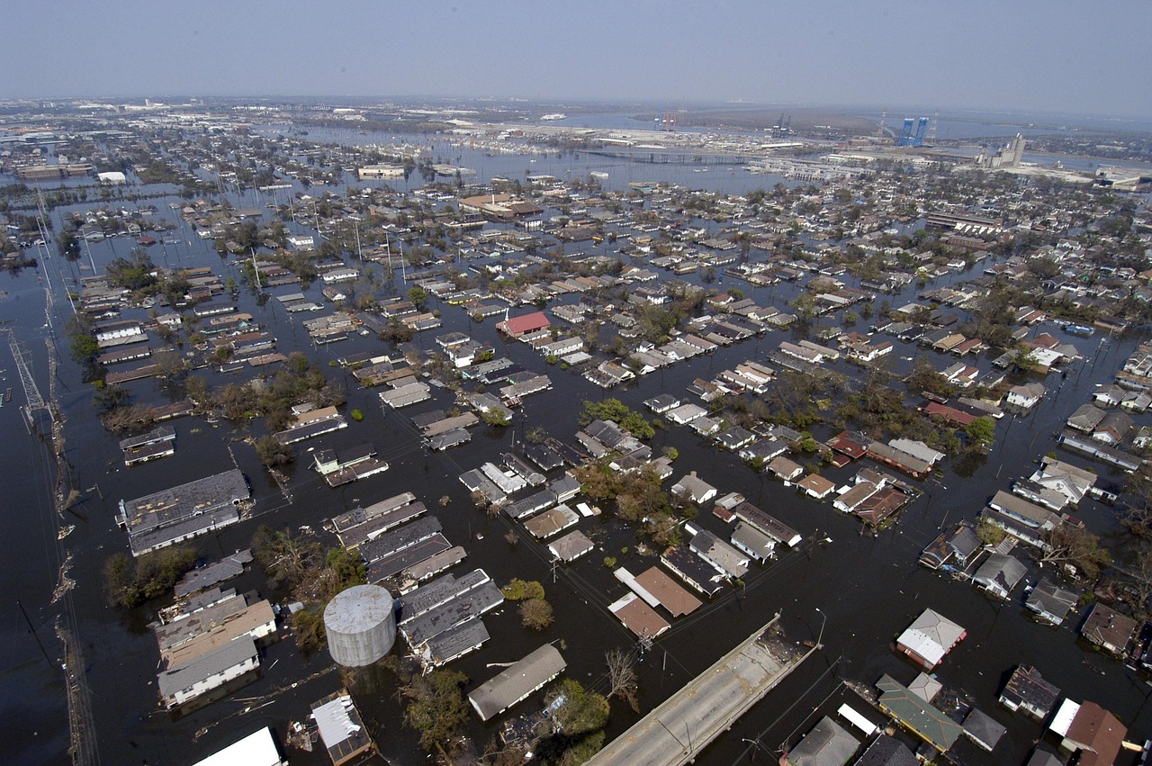
The Deceptive Calm After the Storm
The skies over the American Southwest have finally cleared, offering a brief moment of respite from the relentless downpours that battered the region. For many residents, the absence of dark clouds might signal that the immediate danger has passed. However, meteorologists and emergency management officials are issuing stark warnings that the threat level remains critically high. The visual absence of rain is misleading; the ground itself has transformed into a saturated sponge that can no longer absorb any further moisture. This creates a volatile environment where even minor drizzles can trigger catastrophic flooding in areas that typically experience arid conditions.
This phenomenon is particularly dangerous because it exploits a common human psychological trap: the assumption that safety returns when the sky brightens. In normally arid landscapes, the subsoil is often compacted and dry, lacking the organic matter necessary to hold water. Once the surface layer saturates, any additional precipitation runs off rapidly. This runoff does not simply stay on the surface; it channels into dry washes, arroyos, and urban storm drains that were not designed for such volume. For ordinary readers, the key takeaway is that the end of the rain event is not the end of the hazard. The danger period often extends for hours or even days after the last drop falls.
Why Arid Regions Are Uniquely Vulnerable
To understand the severity of the current situation, it is essential to look at the geological and hydrological factors at play. The US Southwest, encompassing parts of Arizona, New Mexico, Nevada, and California, is characterized by flash flood-prone terrain. Unlike temperate regions with deep, fertile topsoil, these areas are dominated by rocky basins and steep slopes. When heavy rain hits this landscape, the water cannot infiltrate the ground effectively. Instead, it moves with incredible speed and force, picking up debris and eroding banks as it goes.
- Soil Saturation: Once the top few inches of soil are full, absorption capacity drops to near zero.
- Topography: Steep gradients accelerate water flow, turning gentle streams into raging torrents within minutes.
- Lack of Infrastructure: Many rural areas lack robust drainage systems capable of handling sudden, massive volumes of water.
This combination means that flash floods in the Southwest can be just as devastating as those in traditionally wet regions, if not more so, due to the speed at which they develop and the lack of prior notice for out-of-town visitors who may not be aware of the local terrain risks.
Key Factors Driving the Recent Surge
Recent atmospheric patterns have contributed significantly to the intensity of the flooding risks currently facing the Southwest. While the specific storms have moved on, the legacy of the precipitation remains. Over the past several days, multiple systems dumped significant amounts of rain onto the same areas, preventing the soil from drying out between events. This cumulative effect is crucial; a single storm might be manageable, but consecutive storms saturate the landscape entirely. For property owners, this means that their land may be holding more water than it has seen in years, increasing the pressure on any subsequent weather system.
Furthermore, the timing of these events often coincides with the late summer or early autumn monsoon season, a period known for intense, localized thunderstorms. The interaction between large-scale weather systems and local topography creates what meteorologists call a "perfect storm" for flooding. The recent clearance of clouds offers a visual pause, but the hydrological cycle is still in motion. Water is still moving through the watershed, and the potential for secondary flooding remains substantial as long as the ground remains wet.
Competing Perspectives on Risk Assessment
There is often a disconnect between public perception and professional risk assessment. Many residents and visitors tend to rely on visual cues of safety, such as clear skies, to make decisions about travel and outdoor activities. However, emergency managers operate on data-driven models that track soil moisture, rainfall accumulation, and channel capacity. These two viewpoints rarely align in the immediate aftermath of a storm. While a resident might feel safe standing on their porch, a hydrologist is monitoring upstream water levels that have not yet crested.
This gap in understanding can lead to tragic outcomes. When people underestimate the risk, they may attempt to drive through flooded washes or venture into canyons that appear dry but are actually primed for failure. Officials have emphasized that the risk is not binary; it is a gradient. The further downstream one travels, the longer the delay before water arrives, but the greater the volume. Understanding this delay is critical for personal safety. The "clear sky" is merely a pause, not a cessation, of the hydrological threat.
Impact on Infrastructure and Daily Life
The high flood risk extends beyond natural landscapes to affect critical infrastructure. Urban areas in the Southwest are increasingly vulnerable to flash flooding due to the prevalence of impermeable surfaces like concrete and asphalt. These materials prevent water absorption and direct runoff directly into storm drains, which can become overwhelmed quickly. When this happens, streets become highways for water, trapping vehicles and causing significant property damage. For commuters, this means that even after the rain stops, roads may remain unsafe for hours as water levels slowly recede and debris clears.
Additionally, the risk to water treatment facilities is a growing concern. Heavy runoff can carry contaminants, sediment, and debris into municipal water systems, potentially compromising the quality of drinking water. Utilities often issue boil water advisories in such scenarios, disrupting daily life and requiring residents to plan for alternative water sources. This indirect impact of flooding is often overlooked but can have profound implications for public health and economic stability in affected communities. The cost of repairing damaged infrastructure and restoring services can place a significant burden on local governments and taxpayers.
Outlook and What to Watch Next
As the region looks ahead, the focus must remain on monitoring soil moisture levels and upstream water flow, rather than solely watching the sky. Meteorologists advise that the flood risk will remain elevated for at least the next 24 to 48 hours, or until the soil has had sufficient time to drain. Residents should continue to avoid low-lying areas, washes, and canyon floors. Travelers should check for road closures and be prepared for sudden changes in conditions. The coming days will be critical in determining whether the recent storms will lead to long-term erosion or more widespread flooding events. Vigilance is not just recommended; it is necessary.